Sunday, May 15, 2016

Download the latest version of Google Earth for PC, Mac, or Linux

Download the latest version of Google Earth for PC, Mac, or Linux

Description:

Google Earth is a updated map that has an impressive graphics engine. It also boasts abundant layers of content with an enormous amount of information on the site of your interest. It has easy-to-use measuring and marking tools and is compatible with various formats of GPS data.

Improvements in this version are important because they have to do with the revocation of SSL certificates, which means that it adds a computer protocol that ensures the security of data sent over the Internet using an encrypted code.

He also improves lighting in panoramic view and display of balloons.

 System requirements:

PC: Windows XP, Windows Vista, or Windows 7

Mac: Mac OS X 10.6.0 or later versions

Linux: libraries LSB 4.0 (Linux Standard Base).

New items in this version:

Fly over the new images in 3D.

Discover famous sites with tourist guide function.

Official download link here


Saturday, May 14, 2016

Versions of Google Earth

Versions of Earth Google

The Google Earth software is available in several versions:

According to the level of benefits: these are divided into two paid versions and a free version.
Depending on the operating system: Google provides updates for Windows (XP and 2000), and the novelty of 2006 is the version for Mac OS operating system. On June 12, 2006, Google released the first version of Google Earth for Linux (Beta 4).
The version of Google, 4.x, has a component that allows that he is displayed on any operating system, referred to as QT4, product of a Dutch company. Therefore the usability in terms of operating systems is very extensive.
Version 5 allowed the three-dimensional scan of the bottom of the oceans, by adding, at the same time, animation of movement of surface water in seas and oceans. In this regard was also added a specific layer of information.
Version 6.0.0.1735 beta allows better integration of Google Street View in Google Earth. Add trees in three dimensions for some cities in the United States, Europe and Japan. Access to historical images (where any) was also streamlined.
The latest version (6.2) integrates the possibility to login with Google account, save the data stored in Google Earth and share photos taken on Google +.

Friday, May 13, 2016

Google Earth Flight Simulator

Google Earth Flight Simulator

Google Earth offers this tool, which combines teaching and purely recreational elements, making it possible to carry out simulations of air navigation with remarkable fidelity.

The user who operates flights with this feature keep in mind the following recommendations, in order to turn their game into something educational and enjoyable:

It is important to make the first flights with the SR-22 model that the system provides.
It is also advisable that the first landings are rehearsed with model SR 22. Low cruising speed and its easy maneuverability make it very suitable to practice correctly the arrival to the track.
It is advisable to drive the aircraft using the arrow keys by simultaneously pressing the Shift key. If you don't activate this key to give direction to the ship, it would begin to tilt left and right and if the user does not have much skill, you can not already level it.
Although it is not essential that you ask the system to show the names of cities or rivers, yes it should be that the user use the compass provided by Google Earth. It is also recommended that note that the latitude and longitude accurate destination addresses which, because it is very easy to lose the notion of trajectory that takes.
Finally, for landing it should bear in mind these guidelines:

In addition to taking the precautions indicating manual, ideal for reaching track speed ranges, the SR-22, between 70 and 160 mph, and, for the Viper, in a spectrum that records successful landings at 130 mph to 200 mph.
As it's a complicated maneuver, the system recognizes how successful landing but the aircraft out of the line of the track or even reaches the outside area of the airport.
The Simulator allows landings on any route or any field, provided they present a surface without oscillations and the manoeuvre is carried out properly.
The SR-22 stabilizes the fuselage itself only, but the Viper needs to be driven by a user which stabilize the fuselage when the plane starts the final descent, because otherwise, the impact on the floor is so strong that the Google Earth recorded the maneuver as an accident and automatically interrupts the session. The best way to stabilize the fuselage is, on the one hand, keep the activated shift key and gently press the up or down arrows: another option is when the track is 600 meters, apply speed to the aircraft so lift your nose and arrange better landing gear, then return to decrease the speed. Taking into account these precautions, the chances of a failed landing are minimal.
Although experienced users landing aircraft no matter from what angle are approaching the track, it is recommended that the beginner correctly note that the latitude and longitude of the airport and that arbitrate all media to accommodate, with the greatest possible anticipation, ship the Meridian - or parallel - appropriate. Thus, in the final arrival, you can concentrate on stability and gradual braking of the Viper without thinking of the final positioning of the aircraft. In the event that it does not have that possibility, must take into account the more advances fast aircraft, easier is fit the track path. Started landing, it must be properly slowed to avoid the dismissal.
And if little, the two aircraft can go even under the water of the oceans as a submarine. There you can see the hills that are under water or if not marine volcanoes etc.

Thursday, May 12, 2016

Google Earth 3D buildings

Google Earth 3D buildings

Google Earth displays a layer where models of buildings and constructions that can be seen in its three-dimensional form. Initially, existing in Google Earth 3D models were usually created by users around the world with the Google SketchUp or Google Building Maker tool. Currently, anyone can add models to Google Earth. These virtual buildings are then exported the native extension of Google Earth kmz, and are subject to approval by Google. Once approved are published through the buildings in 3D.

However, during 2013 began to come into cities automatically played with help of LIDAR technology, based on aerial shots. This mode gets rebuild complete physiognomy of the city in a more homogeneous manner and rendered in not-too-close view. Effective October 1, 2013 Google prescindirĂ¡ models which users, to incorporate its LIDAR technology to all regions of the world.

Features:
Google Earth allows you to enter the name of a hotel, school or street and get the exact address, a plane, or view of the place. Satellite images of the planet can also be displayed. Also offers 3D features like giving volume to valleys and mountains, and in some cities have even modeled the buildings. The move on the screen is easy and intuitive, with simple and manageable dashboards.

In addition, it is possible to share with others users links, measure geographic distances, see the height of the mountains, see faults or volcanoes and change the view both horizontally and vertically.

Google Earth also has connection with GPS (Global Positioning System), data from file and database feed their paid versions.

It also has a Flight Simulator in Google Earth quite real that can fly over anywhere on the planet.

Version 4 has added significant improvements:

Interface in English, Spanish, French and German.
Relationship with SketchUp, a program of 3D modeling 3D models of buildings from which can be uploaded to Google Earth.
Control Panel that interferes more discreet and wins in space for the display of images.
Improvements that allow you to view "textured" 3D images (more realistic surfaces, windows, bricks...)
Version in the three major operating systems for personal computers (Windows, Linux, and MAC).

Wednesday, May 11, 2016

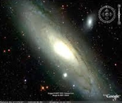
The Moon, Mars and Hubble with Google Earth

The Moon, Mars and Hubble with Earth Google

The latest version (5.0) of Google Earth enable the user to see images in 3D of the Moon and the planet Mars, Google Earth you can:

Make visits landing places-guided, narrated by the astronauts of the Apollo program.
View 3D models of ships of space missions.
See pictures at 360 degrees and discover details such as traces of the astronauts.
See unpublished television images of the missions of the Apollo program.

With the function of Mars in Google Earth, you can:
View images downloaded by NASA makes only a few hours in the layer of live from Mars.
Take an interactive tour to Mars.
View 3D models of vehicles explorers and follow their travels
See high-resolution 360-degree panoramic views.
Look for famous places of the Martian landscape, as the face of Mars or Mount Olympus.

The telescope Hubble in orbit in 1990:
The NASA Hubble Telescope has revolutionized astronomy and has served as inspiration for a whole generation thanks to the wonderful prospects of the universe that offers. Through this application, are allowed to observe 20 favorite images of the Space Telescope Science Institute allowing us to travel to the ends of the universe.

Tuesday, May 10, 2016

How to save and restore your Google Earth Cache

How to save and restore your Earth Google Cache

For lovers of geography Google Earth is a technological marvel, those who, like me, have spent hours virtually navigating sites that we've ever been and we never go, they will agree with me.

A much appreciated feature is to store navigation data in a file cache on the hard drive that allows us to browse offline without perceiving the difference that being connected to the network. This is really important when you go to a place where there isn't any access to the internet and carry all the information that you could save that location, also for people like me that the time of access to the internet is limited by what we have to take advantage of the resources of the programme in the cache of your netbook.

But that disappointment when we note that it was deleted what we had already saved and that cost us time download. Technically Google Earth has a cache file that will keeping all our navigation data, but often when we re-connect overwrites it and there is no way to recover it.

The only solution option to avoid this and make sure that we have a clean copy safe from everything we are able to download consists of the following:

Create multiple cache files, which you can download in different sessions, save them and then load them separately, in the same way to as open with our software Word several different, independent documents one of others.

By default Google Earth saves your file cache on the route c:UsersnombredeusuarioAppDataLocalLowGoo gleGoogleEarth if you use Windows Vista or 7, what we'll do next is get off two small bat files that will do all the work of backup and restoration by us. One of them called 1crear_backup creates a copy of your cache and the other 2restaurar_backup restore the backup that you want to browse while disconnected from the network.

Assuming that you already conectaste Internet, sailed by the places that interest you and saved everything you could, then close the program and disconnect from the network.

Run the first file called: 1crear_backup, the will automatically create a copy of the cache of the application in a folder called BACKUP, the command will create in drive D, in case that you have only a unit, create the folder on drive C.

Manually rename the copy called GoogleEarth with the name that you want to differentiate them from which they will do another time, for example NewYorkCity (preferably well without spaces).

Then get a copy of the second command called 2restaurar_backup inside that folder and so on every time you make a new copy has to be inside a copy of the second command.

You can subsequently make many copies of cache you want, each of them with the second command inside.

When you decide to browse offline in one of these locations or even add more data to the cache simply, (two clicks) the command 2restaurar_backup that has within it the copy that you choose and it will replace the original file from Google Earth with the copy that you chose. Will always be a except files in the BACKUP folder, even though you have to reinstall the operating system (of course if they are not on the C drive).

When you go to cache a new zone runs Google Earth and enters in tools > options > Cache and press delete cache file allowing you to create one from scratch.

The procedure is quite simple even for users who do not have any knowledge of computing or no skill in the use of PC.

Monday, May 9, 2016

What is Google Earth?

Google Earth?

Google Earth is a computer program that displays a virtual globe that displays multiple cartography, photography-based satellite.

The program was created under the name of EarthViewer 3D Keyhole Inc company, financed by the Central Intelligence Agency. The company was bought by Google in 2004 by absorbing the application.

Google Earth map is composed of a superimposition of images obtained from satellite, aerial photography, geographic information from images of the world GIS data models and models created by computer. The program is available in several licenses, but the free version is the most popular available for mobile devices, tablets, and personal computers.

The first version of Google Earth was launched in 2005 and is currently available on PC for Windows, Mac and Linux. Google Earth is also available as a plugin to be viewed from the web browser. In 2013 Google Earth had become the most popular program to visualize cartography, with more than 1 billion downloads. 1 2

Many users use the application to add their own data, making them available through various sources, such as blogs or Bulletin Board Systems. Google Earth can show different layers of image on top of the base and is also a valid client for a Web Map Service. Google Earth supports by using the Keyhole Markup Language files three-dimensional geospatial data or. kml.

Development
Initially, Keyhole was a program of payment until October 27, 2004 it was purchased by Google. On 21 May 2005 Keyhole was renamed Google Earth. In June 2005 the main novelty was, apart from the change of name and owner, that the program had a free version (unlike Keyhole, which was payment in all its versions, although it was possible to have a trial version for a limited time). This program also incorporates Maps, which serves to find streets, avenues and business and enlarge them in a very realistic way.

Versions
The Google Earth software is available in several versions:

According to the level of benefits: these are divided into two paid versions and a free version.
Depending on the operating system: Google provides updates for Windows (XP and 2000), and the novelty of 2006 is the version for Mac OS operating system. On June 12, 2006, Google released the first version of Google Earth for Linux (Beta 4).
The version of Google, 4.x, has a component that allows that he is displayed on any operating system, referred to as QT4, product of a Dutch company. Therefore the usability in terms of operating systems is very extensive.
Version 5 allowed the three-dimensional scan of the bottom of the oceans, by adding, at the same time, animation of movement of surface water in seas and oceans. In this regard was also added a specific layer of information.
Version 6.0.0.1735 beta allows better integration of Google Street View in Google Earth. Add trees in three dimensions for some cities in the United States, Europe and Japan. Access to historical images (where any) was also streamlined.
The latest version (6.2) integrates the possibility to login with Google account, save the data stored in Google Earth and share photos taken on Google +.